
Make a donation
Gear up for your next adventure:
As an Amazon Associate, this site earns from qualifying purchases at no extra cost to you.
Saxony-Anhalt topographic map
Click on the map to display elevation.
Make a donation
Gear up for your next adventure:
As an Amazon Associate, this site earns from qualifying purchases at no extra cost to you.
About this map
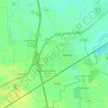
Name: Saxony-Anhalt topographic map, elevation, terrain.
Location: Saxony-Anhalt, 06796, Germany (51.53103 12.16488 51.58457 12.24420)
Average elevation: 318 ft
Minimum elevation: 292 ft
Maximum elevation: 348 ft
Make a donation
Gear up for your next adventure:
As an Amazon Associate, this site earns from qualifying purchases at no extra cost to you.
Other topographic maps
Click on a map to view its topography, its elevation and its terrain.
Brocken
Germany > Saxony-Anhalt > Landkreis Harz > Wernigerode
The Brocken, also sometimes referred to as the Blocksberg, is the highest peak in the Harz mountain range and also the highest peak in Northern Germany; it is near Schierke in the German state of Saxony-Anhalt between the rivers Weser and Elbe. Although its elevation of 1,141 metres (3,743 ft) is below alpine…
Average elevation: 3,159 ft
Make a donation
Gear up for your next adventure:
As an Amazon Associate, this site earns from qualifying purchases at no extra cost to you.
Plößnitz
Germany > Saxony-Anhalt > Burgenlandkreis > Laucha an der Unstrut > Plößnitz
Average elevation: 676 ft
Lutherstadt Wittenberg
Germany > Saxony-Anhalt > Wittenberg > Wittenberg > Lutherstadt Wittenberg
Average elevation: 259 ft