
Thank you for supporting this site ❤️
Make a donation
Make a donation
Gear up for your next adventure:
As an Amazon Associate, this site earns from qualifying purchases at no extra cost to you.
Saas topographic map
Click on the map to display elevation.
Thank you for supporting this site ❤️
Make a donation
Make a donation
Gear up for your next adventure:
As an Amazon Associate, this site earns from qualifying purchases at no extra cost to you.
About this map
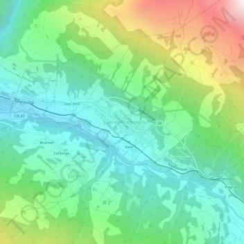
Name: Saas topographic map, elevation, terrain.
Location: Saas, Klosters, Prättigau/Davos, Grisons, 7247, Switzerland (46.89086 9.78852 46.93086 9.82852)
Average elevation: 4,229 ft
Minimum elevation: 2,680 ft
Maximum elevation: 7,841 ft
Thank you for supporting this site ❤️
Make a donation
Make a donation
Gear up for your next adventure:
As an Amazon Associate, this site earns from qualifying purchases at no extra cost to you.