
樟树市 topographic map
Interactive map
Click on the map to display elevation.
About this map
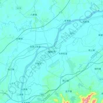
Name: 樟树市 topographic map, elevation, terrain.
Location: 樟树市, 淦阳街道, 樟树市, 宜春市, 江西省, 331200, 中国 (27.89938 115.38098 28.21938 115.70098)
Average elevation: 141 ft
Minimum elevation: 46 ft
Maximum elevation: 1,936 ft
Other topographic maps
Click on a map to view its topography, its elevation and its terrain.