Geolocate

吴城乡 topographic map

Interactive map

Click on the map to display elevation.

About this map

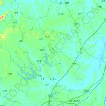
Name: 吴城乡 topographic map, elevation, terrain.

Location: 吴城乡, 樟树市, 宜春市, 江西省, 中国 (27.94011 115.17627 28.11667 115.34904)

Average elevation: 164 ft

Minimum elevation: 85 ft

Maximum elevation: 564 ft

Other topographic maps

Click on a map to view its topography, its elevation and its terrain.

茂林

中国 > 江西省 > 樟树市 > 经楼镇

茂林, 经楼镇, 樟树市, 宜春市, 江西省, 中国

Average elevation: 135 ft

洋湖村

中国 > 江西省 > 樟树市 > 洋湖乡

洋湖村, 洋湖乡, 樟树市, 宜春市, 江西省, 中国

Average elevation: 112 ft

阁皂山

中国 > 江西省 > 樟树市 > 店下镇

阁皂山, 店下镇, 樟树市, 宜春市, 江西省, 中国

Average elevation: 791 ft

槎山

中国 > 江西省 > 樟树市 > 张家山街道

槎山, 张家山街道, 樟树市, 宜春市, 江西省, 中国

Average elevation: 98 ft

樟树市

中国 > 江西省 > 樟树市

樟树市, 淦阳街道, 樟树市, 宜春市, 江西省, 331200, 中国

Average elevation: 141 ft