Geolocate

Nangal topographic map

Click on the map to display elevation.

About this map

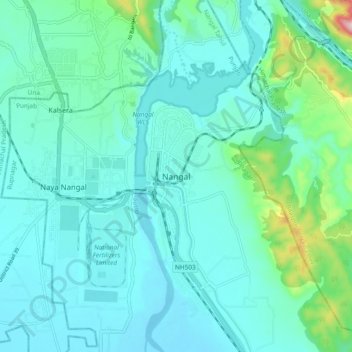
Name: Nangal topographic map, elevation, terrain.

Location: Nangal, Nangal Tahsil, Rupnagar, Punjab, 140124, India (31.34375 76.33544 31.42375 76.41544)

Average elevation: 1,263 ft

Minimum elevation: 1,093 ft

Maximum elevation: 2,178 ft

Gear up for your next adventure:

🪶Survival Guide Book - Expert advice for emergency preparedness
📚USA Hiking Guide Books - Top trail guides and map books
🚗GPS Dash Cams - Record your scenic drives through mountain passes and canyons
🖼️Topo Map Wall Art - Decorative topographic prints of famous peaks and regions
🪄Magnetic Compass - Accurate compass for navigation

As an Amazon Associate, this site earns from qualifying purchases at no extra cost to you.