Geolocate

Canelo topographic map

Click on the map to display elevation.

About this map

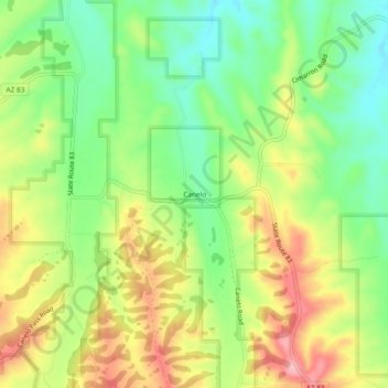
Name: Canelo topographic map, elevation, terrain.

Location: Canelo, Santa Cruz County, Arizona, United States (31.52287 -110.53453 31.56287 -110.49453)

Average elevation: 5,079 ft

Minimum elevation: 4,882 ft

Maximum elevation: 5,322 ft

Santa Cruz County trails, hiking, mountain biking, running and outdoor activities

Gear up for your next adventure:

🛰️Satellite Messengers - Emergency SOS and two-way messaging for off-grid adventures
🪶Paracord Bracelet - Survival bracelet with built‑in tools
🌡️Handheld Weather Meters - Measure wind, temp, and pressure for safe mountain travel
🏔️Mountain Trail Maps - High‑detail maps for popular peaks
🖼️Topo Map Wall Art - Decorative topographic prints of famous peaks and regions

As an Amazon Associate, this site earns from qualifying purchases at no extra cost to you.