Geolocate

Sasmuan topographic map

Click on the map to display elevation.

About this map

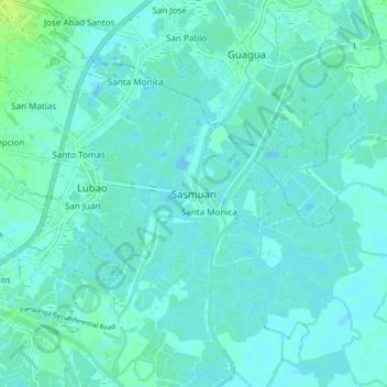
Name: Sasmuan topographic map, elevation, terrain.

Location: Sasmuan, Pampanga, Central Luzon, 2004, Philippines (14.89649 120.58229 14.97649 120.66229)

Average elevation: 10 ft

Minimum elevation: -7 ft

Maximum elevation: 39 ft

Other topographic maps

Click on a map to view its topography, its elevation and its terrain.

San Simon

Philippines > Pampanga

Average elevation: 16 ft

Arayat

Philippines > Pampanga

Average elevation: 128 ft

Candaba

Philippines > Pampanga

Average elevation: 79 ft

San Agustin

Philippines > Pampanga > Candaba

Average elevation: 20 ft

Bahay Pare

Philippines > Pampanga > Candaba

Average elevation: 33 ft

Santo Tomas

Philippines > Pampanga > Santo Tomas

Average elevation: 13 ft

San Esteban

Philippines > Pampanga

Average elevation: 10 ft

Lourdes

Philippines > Pampanga > Candaba

Average elevation: 33 ft

Gear up for your next adventure:

🔭Telescopic Hiking Pole - Adjustable pole for hiking stability
🪶Wildlife Field Guides - Learn animal tracking and species ID
🎒Gear Packing Cubes - Organize your backpack efficiently
🧺Microfiber Travel Towels - Compact and fast-drying towels for trail use
🪶Multi‑Purpose Knife - Useful blade for camp and trail

As an Amazon Associate, this site earns from qualifying purchases at no extra cost to you.