
Thank you for supporting this site ❤️
Make a donation
Make a donation
Gear up for your next adventure:
As an Amazon Associate, this site earns from qualifying purchases at no extra cost to you.
Arjuno-Welirang topographic map
Click on the map to display elevation.
Thank you for supporting this site ❤️
Make a donation
Make a donation
Gear up for your next adventure:
As an Amazon Associate, this site earns from qualifying purchases at no extra cost to you.
About this map
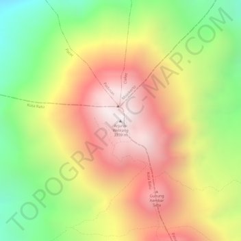
Name: Arjuno-Welirang topographic map, elevation, terrain.
Location: Arjuno-Welirang, Kota Batu, East Java, Java, Indonesia (-7.73431 112.57494 -7.73421 112.57504)
Average elevation: 8,829 ft
Minimum elevation: 7,083 ft
Maximum elevation: 10,312 ft
Thank you for supporting this site ❤️
Make a donation
Make a donation
Gear up for your next adventure:
As an Amazon Associate, this site earns from qualifying purchases at no extra cost to you.