
Thank you for supporting this site ❤️
Make a donation
Make a donation
Gear up for your next adventure:
As an Amazon Associate, this site earns from qualifying purchases at no extra cost to you.
Escarigo topographic map
Click on the map to display elevation.
Thank you for supporting this site ❤️
Make a donation
Make a donation
Gear up for your next adventure:
As an Amazon Associate, this site earns from qualifying purchases at no extra cost to you.
About this map
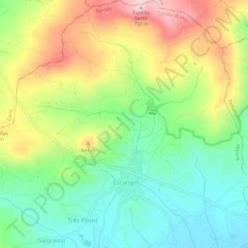
Name: Escarigo topographic map, elevation, terrain.
Location: Escarigo, Três Povos, Fundão, Castelo Branco, Portugal (40.23794 -7.31115 40.27236 -7.26653)
Average elevation: 1,854 ft
Minimum elevation: 1,499 ft
Maximum elevation: 2,385 ft
Thank you for supporting this site ❤️
Make a donation
Make a donation
Gear up for your next adventure:
As an Amazon Associate, this site earns from qualifying purchases at no extra cost to you.