
Make a donation
Gear up for your next adventure:
As an Amazon Associate, this site earns from qualifying purchases at no extra cost to you.
Charlotte topographic map
Click on the map to display elevation.
Make a donation
Gear up for your next adventure:
As an Amazon Associate, this site earns from qualifying purchases at no extra cost to you.
About this map
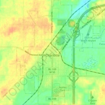
Name: Charlotte topographic map, elevation, terrain.
Location: Charlotte, Eaton County, Michigan, United States (42.53857 -84.86060 42.59164 -84.78802)
Average elevation: 912 ft
Minimum elevation: 853 ft
Maximum elevation: 965 ft
Eaton County trails, hiking, mountain biking, running and outdoor activities
Make a donation
Gear up for your next adventure:
As an Amazon Associate, this site earns from qualifying purchases at no extra cost to you.
Other topographic maps
Click on a map to view its topography, its elevation and its terrain.
Grand Ledge
United States > Michigan > Eaton County > Grand Ledge > Grand Ledge
Average elevation: 850 ft