
El Encino topographic map
Interactive map
Click on the map to display elevation.
About this map
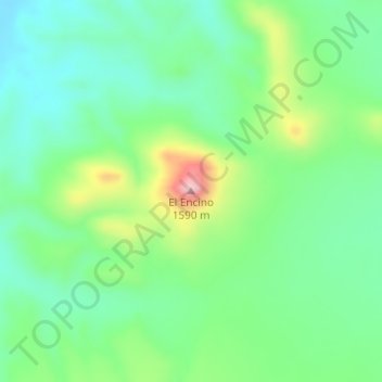
Name: El Encino topographic map, elevation, terrain.
Location: El Encino, Satevó, Chihuahua, México (27.86081 -105.84095 27.86091 -105.84085)
Average elevation: 4,787 ft
Minimum elevation: 4,560 ft
Maximum elevation: 5,292 ft
Other topographic maps
Click on a map to view its topography, its elevation and its terrain.
El Palomar
México > Chihuahua > Satevó > El Chamizal
El Palomar, El Chamizal, Satevó, Chihuahua, México
Average elevation: 4,810 ft
San Rafael
México > Chihuahua > Satevó > La Cieneguilla
San Rafael, La Cieneguilla, Satevó, Chihuahua, México
Average elevation: 4,718 ft
San Jose del Sitio
San Jose del Sitio, Satevó, Chihuahua, México
Average elevation: 5,020 ft