
Chelsea topographic map
Click on the map to display elevation.
About this map
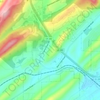
Name: Chelsea topographic map, elevation, terrain.
Location: Chelsea, Shelby County, Alabama, United States (33.33954 -86.67411 33.37616 -86.64490)
Average elevation: 699 ft
Minimum elevation: 472 ft
Maximum elevation: 1,135 ft
Shelby County trails, hiking, mountain biking, running and outdoor activities