
Davis Dam topographic map
Click on the map to display elevation.
About this map
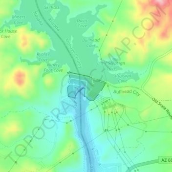
Name: Davis Dam topographic map, elevation, terrain.
Average elevation: 709 ft
Minimum elevation: 505 ft
Maximum elevation: 1,161 ft
Mohave County trails, hiking, mountain biking, running and outdoor activities
Other topographic maps
Click on a map to view its topography, its elevation and its terrain.
Bullhead City
United States > Arizona > Mohave County > Bullhead City > Bullhead City
Average elevation: 804 ft