
Thank you for supporting this site ❤️
Make a donation
Make a donation
Gear up for your next adventure:
As an Amazon Associate, this site earns from qualifying purchases at no extra cost to you.
Deulgaon Raja topographic map
Click on the map to display elevation.
Thank you for supporting this site ❤️
Make a donation
Make a donation
Gear up for your next adventure:
As an Amazon Associate, this site earns from qualifying purchases at no extra cost to you.
About this map
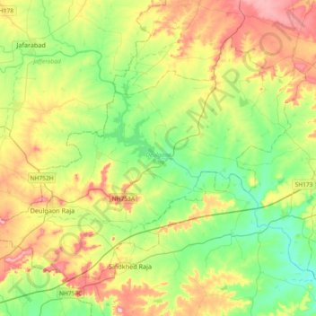
Name: Deulgaon Raja topographic map, elevation, terrain.
Location: Deulgaon Raja, Buldhana, Maharashtra, India (19.93928 75.96259 20.20393 76.32979)
Average elevation: 1,804 ft
Minimum elevation: 1,591 ft
Maximum elevation: 2,156 ft
Thank you for supporting this site ❤️
Make a donation
Make a donation
Gear up for your next adventure:
As an Amazon Associate, this site earns from qualifying purchases at no extra cost to you.