
Thank you for supporting this site ❤️
Make a donation
Make a donation
Gear up for your next adventure:
As an Amazon Associate, this site earns from qualifying purchases at no extra cost to you.
Senanga topographic map
Click on the map to display elevation.
Thank you for supporting this site ❤️
Make a donation
Make a donation
Gear up for your next adventure:
As an Amazon Associate, this site earns from qualifying purchases at no extra cost to you.
About this map
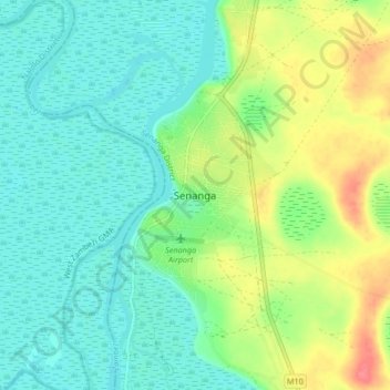
Name: Senanga topographic map, elevation, terrain.
Location: Senanga, Senanga District, Western Province, Zambia, Zambia (-16.14410 23.26181 -16.06410 23.34181)
Average elevation: 3,333 ft
Minimum elevation: 3,268 ft
Maximum elevation: 3,474 ft
Thank you for supporting this site ❤️
Make a donation
Make a donation
Gear up for your next adventure:
As an Amazon Associate, this site earns from qualifying purchases at no extra cost to you.