Geolocate

Jefferson topographic map

Click on the map to display elevation.

About this map

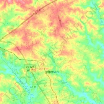
Name: Jefferson topographic map, elevation, terrain.

Location: Jefferson, Jackson County, Georgia, 30549, United States (34.07923 -83.67439 34.20015 -83.54486)

Average elevation: 814 ft

Minimum elevation: 659 ft

Maximum elevation: 1,007 ft

Jackson County trails, hiking, mountain biking, running and outdoor activities

Gear up for your next adventure:

☀️Outdoor Sunscreen - High protection sunscreen for outdoor activities
🔭Stargazing Telescopes - Perfect for camping in low-light pollution areas shown on maps
🎒Gear Packing Cubes - Organize your backpack efficiently
📡Handheld GPS Device - Reliable handheld GPS for outdoor navigation
📦Gear Storage Bags - Organize and protect outdoor equipment

As an Amazon Associate, this site earns from qualifying purchases at no extra cost to you.