Geolocate

Loranger topographic map

Click on the map to display elevation.

About this map

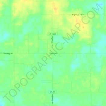
Name: Loranger topographic map, elevation, terrain.

Location: Loranger, Tangipahoa Parish, Louisiana, 70446, United States (30.61574 -90.41814 30.65574 -90.37814)

Average elevation: 115 ft

Minimum elevation: 75 ft

Maximum elevation: 157 ft

Tangipahoa Parish trails, hiking, mountain biking, running and outdoor activities

Other topographic maps

Click on a map to view its topography, its elevation and its terrain.

Tickfaw

United States > Louisiana > Tangipahoa Parish

Average elevation: 62 ft

Kentwood

United States > Louisiana > Tangipahoa Parish

Average elevation: 226 ft

Gear up for your next adventure:

🏕️Tent Footprint - Protect your tent base from wear
📶Satellite Messenger - Communication device off‑grid
🛰️Satellite Messengers - Emergency SOS and two-way messaging for off-grid adventures
🧺Microfiber Travel Towels - Compact and fast-drying towels for trail use
🥘Titanium Cookware - Durable, featherlight pots and pans for backpacking

As an Amazon Associate, this site earns from qualifying purchases at no extra cost to you.