
Make a donation
Gear up for your next adventure:
As an Amazon Associate, this site earns from qualifying purchases at no extra cost to you.
Lautern topographic map
Click on the map to display elevation.
Make a donation
Gear up for your next adventure:
As an Amazon Associate, this site earns from qualifying purchases at no extra cost to you.
About this map
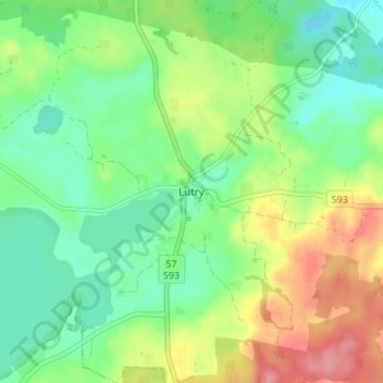
Name: Lautern topographic map, elevation, terrain.
Average elevation: 525 ft
Minimum elevation: 417 ft
Maximum elevation: 705 ft
Make a donation
Gear up for your next adventure:
As an Amazon Associate, this site earns from qualifying purchases at no extra cost to you.
Other topographic maps
Click on a map to view its topography, its elevation and its terrain.
Bischofsburg
Polen > Woiwodschaft Ermland-Masuren > powiat olsztyński
Die Stadt liegt im historischen Ermland, im östlichen Bereich der Allensteiner Seenplatte (poln. Pojezierze Olsztyńskie), die zum masurischen Seengebiet gehört. Auf Gemeindegebiet liegt der Daddaisee (poln. Dadaj), er ist mit 10 km² der größte See der Seenplatte. Dort mündet das kleine Flüsschen Dimmer…
Average elevation: 505 ft
Seeburg
Polen > Woiwodschaft Ermland-Masuren > powiat olsztyński
Nachdem die ermländischen Bischöfe in der zweiten Hälfte des 13. Jahrhunderts begonnen hatten, den als Wildnis beschriebenen Südosten des Bistums zu besiedeln, errichteten sie unter anderem auf einer kleinen Anhöhe am Ufer des Simserflusses eine Burg zum Schutz und als Zufluchtsstätte für die dort…
Average elevation: 466 ft