
Thank you for supporting this site ❤️
Make a donation
Make a donation
Gear up for your next adventure:
As an Amazon Associate, this site earns from qualifying purchases at no extra cost to you.
Minà topographic map
Click on the map to display elevation.
Thank you for supporting this site ❤️
Make a donation
Make a donation
Gear up for your next adventure:
As an Amazon Associate, this site earns from qualifying purchases at no extra cost to you.
About this map
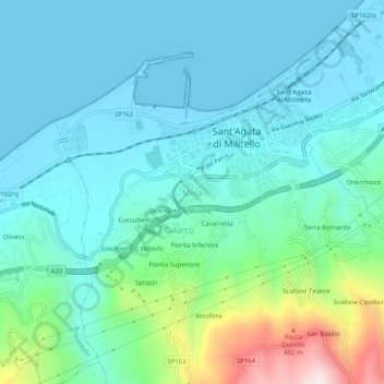
Name: Minà topographic map, elevation, terrain.
Location: Minà, Sant'Agata di Militello, Messina, Sicilia, 98076, Italia (38.04229 14.60745 38.08229 14.64745)
Average elevation: 387 ft
Minimum elevation: -3 ft
Maximum elevation: 1,982 ft
Thank you for supporting this site ❤️
Make a donation
Make a donation
Gear up for your next adventure:
As an Amazon Associate, this site earns from qualifying purchases at no extra cost to you.