Geolocate

Santa Lucia topographic map

Click on the map to display elevation.

About this map

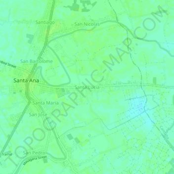
Name: Santa Lucia topographic map, elevation, terrain.

Location: Santa Lucia, Pampanga, Central Luzon, 2022, Philippines (15.07313 120.76046 15.11313 120.80046)

Average elevation: 20 ft

Minimum elevation: 3 ft

Maximum elevation: 30 ft

Other topographic maps

Click on a map to view its topography, its elevation and its terrain.

San Simon

Philippines > Pampanga

Average elevation: 16 ft

Arayat

Philippines > Pampanga

Average elevation: 128 ft

Candaba

Philippines > Pampanga

Average elevation: 79 ft

San Agustin

Philippines > Pampanga > Candaba

Average elevation: 20 ft

Bahay Pare

Philippines > Pampanga > Candaba

Average elevation: 33 ft

Santo Tomas

Philippines > Pampanga > Santo Tomas

Average elevation: 13 ft

San Esteban

Philippines > Pampanga

Average elevation: 10 ft

Lourdes

Philippines > Pampanga > Candaba

Average elevation: 33 ft

Gear up for your next adventure:

🗺️Topographic Maps - Detailed topo maps for hiking, exploring and outdoor navigation
🪶Multi‑Purpose Knife - Useful blade for camp and trail
😴Insulated Sleeping Pads - Compact and warm pads for high-elevation camping
🩹Survival Bandages - High‑quality bandages for emergencies
🪓Survival Multi‑Tool - Versatile tool for camp and trail tasks

As an Amazon Associate, this site earns from qualifying purchases at no extra cost to you.