Geolocate

Canton topographic map

Click on the map to display elevation.

About this map

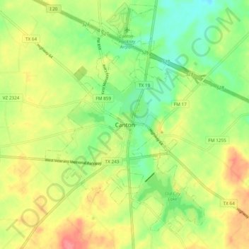
Name: Canton topographic map, elevation, terrain.

Location: Canton, Van Zandt County, Texas, 75103, United States (32.51566 -95.90405 32.59566 -95.82405)

Average elevation: 522 ft

Minimum elevation: 410 ft

Maximum elevation: 653 ft

Van Zandt County trails, hiking, mountain biking, running and outdoor activities

Gear up for your next adventure:

🥤Water Filter Bottle - All‑in‑one filter bottle for safe hydration
🧭Pro Hiking Compasses - High-accuracy liquid-filled compasses for topographic orientation
🧢Outdoor Hiking Hat - Sun protection hat for outdoor explorers
🧺Microfiber Travel Towels - Compact and fast-drying towels for trail use
🧭Outdoor Navigation Book - Learn advanced navigation skills

As an Amazon Associate, this site earns from qualifying purchases at no extra cost to you.