
Thank you for supporting this site ❤️
Make a donation
Make a donation
Gear up for your next adventure:
As an Amazon Associate, this site earns from qualifying purchases at no extra cost to you.
Astica topographic map
Click on the map to display elevation.
Thank you for supporting this site ❤️
Make a donation
Make a donation
Gear up for your next adventure:
As an Amazon Associate, this site earns from qualifying purchases at no extra cost to you.
About this map
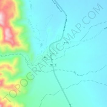
Name: Astica topographic map, elevation, terrain.
Location: Astica, Valle Fértil, San Juan, 5447, Argentina (-30.97566 -67.32306 -30.93566 -67.28306)
Average elevation: 2,523 ft
Minimum elevation: 2,241 ft
Maximum elevation: 3,714 ft
Thank you for supporting this site ❤️
Make a donation
Make a donation
Gear up for your next adventure:
As an Amazon Associate, this site earns from qualifying purchases at no extra cost to you.