Geolocate

Kosciusko topographic map

Click on the map to display elevation.

About this map

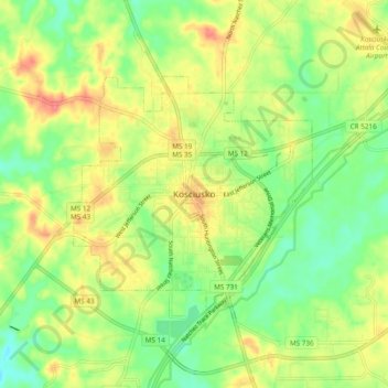
Name: Kosciusko topographic map, elevation, terrain.

Location: Kosciusko, Attala County, Mississippi, 39090, United States (33.01763 -89.62758 33.09763 -89.54758)

Average elevation: 433 ft

Minimum elevation: 335 ft

Maximum elevation: 551 ft

Attala County trails, hiking, mountain biking, running and outdoor activities

Gear up for your next adventure:

🛌Ultralight Sleeping Bags - Compact down bags for cold nights in the wilderness
📌Outdoor GPS Map App - Apps and devices for digital topographic navigation
🪵Folding Camp Saw - Compact saw for wood and campsite work
🎒Gear Packing Cubes - Organize your backpack efficiently
🧥Men's Rain Shells - Premium waterproof and breathable jackets for mountain weather

As an Amazon Associate, this site earns from qualifying purchases at no extra cost to you.