
Oregon topographic map
Click on the map to display elevation.
About this map
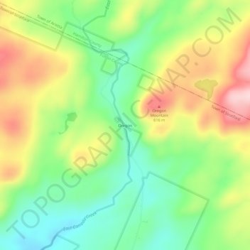
Name: Oregon topographic map, elevation, terrain.
Location: Oregon, Stratford, Fulton County, New York, United States (43.23896 -74.67459 43.27896 -74.63459)
Average elevation: 1,677 ft
Minimum elevation: 1,332 ft
Maximum elevation: 2,146 ft
Fulton County trails, hiking, mountain biking, running and outdoor activities