Geolocate

Fairmont topographic map

Click on the map to display elevation.

About this map

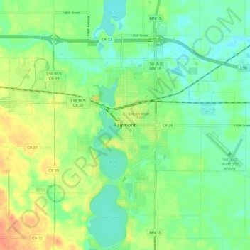
Name: Fairmont topographic map, elevation, terrain.

Location: Fairmont, Martin County, Minnesota, 56031, United States (43.61218 -94.50108 43.69218 -94.42108)

Average elevation: 1,181 ft

Minimum elevation: 1,129 ft

Maximum elevation: 1,263 ft

Gear up for your next adventure:

🧭Orienteering Set - Complete compass and map reading kit
📦Dry Bags Set - Waterproof storage for electronics and clothes
🥾Men's Hiking Boots - Durable, waterproof footwear for rugged terrain and steep inclines
📱Heavy-Duty Phone Cases - Drop-proof and waterproof protection for outdoor navigation
🔦Compact Flashlight - Reliable flashlight for emergencies

As an Amazon Associate, this site earns from qualifying purchases at no extra cost to you.