
Pulau Ranggut topographic map
Click on the map to display elevation.
About this map
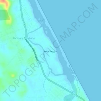
Name: Pulau Ranggut topographic map, elevation, terrain.
Location: Pulau Ranggut, Kampung Merchang, Marang, Terengganu, Malaysia (5.02310 103.29306 5.03591 103.30256)
Average elevation: 16 ft
Minimum elevation: -26 ft
Maximum elevation: 167 ft