Geolocate

Guaynabo topographic map

Click on the map to display elevation.

About this map

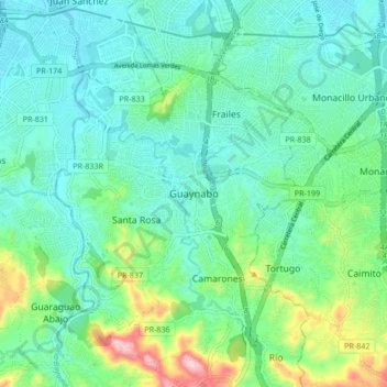
Name: Guaynabo topographic map, elevation, terrain.

Location: Guaynabo, Puerto Rico, 00970, United States (18.31787 -66.15201 18.39787 -66.07201)

Average elevation: 230 ft

Minimum elevation: 16 ft

Maximum elevation: 928 ft

Guaynabo trails, hiking, mountain biking, running and outdoor activities

Gear up for your next adventure:

🧢Sun Protection Hats - Wide-brimmed and UPF-rated hats for high-altitude sun safety
🌧️Backpack Rain Cover - Keep gear dry in wet weather
🛌Ultralight Sleeping Bags - Compact down bags for cold nights in the wilderness
📻Weather Alert Radios - Stay informed of storm risks while off-the-grid
🔦Compact Flashlight - Reliable flashlight for emergencies

As an Amazon Associate, this site earns from qualifying purchases at no extra cost to you.