
Thank you for supporting this site ❤️
Make a donation
Make a donation
Gear up for your next adventure:
As an Amazon Associate, this site earns from qualifying purchases at no extra cost to you.
Bulalang topographic map
Click on the map to display elevation.
Thank you for supporting this site ❤️
Make a donation
Make a donation
Gear up for your next adventure:
As an Amazon Associate, this site earns from qualifying purchases at no extra cost to you.
About this map
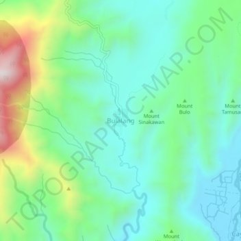
Name: Bulalang topographic map, elevation, terrain.
Location: Bulalang, Bukidnon, Northern Mindanao, Philippines (7.72557 125.34677 7.76557 125.38677)
Average elevation: 2,103 ft
Minimum elevation: 1,450 ft
Maximum elevation: 3,855 ft
Thank you for supporting this site ❤️
Make a donation
Make a donation
Gear up for your next adventure:
As an Amazon Associate, this site earns from qualifying purchases at no extra cost to you.