Geolocate

Rochedale topographic map

Click on the map to display elevation.

About this map

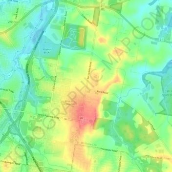
Name: Rochedale topographic map, elevation, terrain.

Location: Rochedale, City of Brisbane, Queensland, 4123, Australia (-27.59535 153.10033 -27.54505 153.14705)

Average elevation: 157 ft

Minimum elevation: 62 ft

Maximum elevation: 302 ft

Other topographic maps

Click on a map to view its topography, its elevation and its terrain.

Enoggera Hill

Australia > Queensland > City of Brisbane

Average elevation: 374 ft

Toohey Mountain

Australia > Queensland > City of Brisbane

Average elevation: 174 ft

Blunder Creek

Australia > Queensland > City of Brisbane

Average elevation: 85 ft

Tangalooma

Australia > Queensland > City of Brisbane

Average elevation: 135 ft

Timberland Park

Australia > Queensland > City of Brisbane

Average elevation: 121 ft

Deepwater Bend

Australia > Queensland > City of Brisbane

Average elevation: 16 ft

Tangalooma

Australia > Queensland > City of Brisbane

Average elevation: 135 ft

Gear up for your next adventure:

🎁Geography Themed Gifts - Unique gift ideas for map lovers and geography enthusiasts
⛑️Personal Locator Beacon - Safety beacon for emergencies
🧭Map Reading Tools - Tools and kits for map navigation
🪵Folding Camp Saw - Compact saw for wood and campsite work
💧Water Purification System - Clean water on the trail with reliable purifiers

As an Amazon Associate, this site earns from qualifying purchases at no extra cost to you.