
Thank you for supporting this site ❤️
Make a donation
Make a donation
Gear up for your next adventure:
As an Amazon Associate, this site earns from qualifying purchases at no extra cost to you.
Delta State topographic map
Click on the map to display elevation.
Thank you for supporting this site ❤️
Make a donation
Make a donation
Gear up for your next adventure:
As an Amazon Associate, this site earns from qualifying purchases at no extra cost to you.
About this map
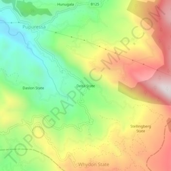
Name: Delta State topographic map, elevation, terrain.
Location: Delta State, Kandy District, Central Province, 20544, Sri Lanka (7.09684 80.65600 7.13684 80.69600)
Average elevation: 4,012 ft
Minimum elevation: 2,776 ft
Maximum elevation: 5,489 ft
Thank you for supporting this site ❤️
Make a donation
Make a donation
Gear up for your next adventure:
As an Amazon Associate, this site earns from qualifying purchases at no extra cost to you.