
Thank you for supporting this site ❤️
Make a donation
Make a donation
Gear up for your next adventure:
As an Amazon Associate, this site earns from qualifying purchases at no extra cost to you.
Goulbourn topographic map
Click on the map to display elevation.
Thank you for supporting this site ❤️
Make a donation
Make a donation
Gear up for your next adventure:
As an Amazon Associate, this site earns from qualifying purchases at no extra cost to you.
About this map
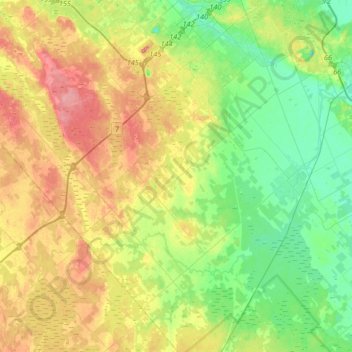
Name: Goulbourn topographic map, elevation, terrain.
Location: Goulbourn, Ottawa, Est de l'Ontario, Ontario, Canada (45.07991 -76.07499 45.31313 -75.79771)
Average elevation: 390 ft
Minimum elevation: 282 ft
Maximum elevation: 545 ft
Thank you for supporting this site ❤️
Make a donation
Make a donation
Gear up for your next adventure:
As an Amazon Associate, this site earns from qualifying purchases at no extra cost to you.