Geolocate

Sheboygan topographic map

Click on the map to display elevation.

About this map

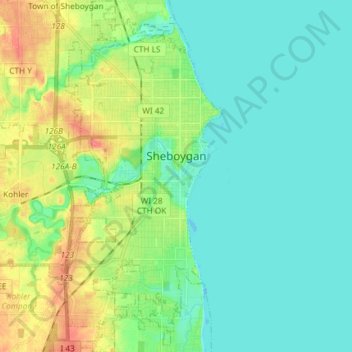
Name: Sheboygan topographic map, elevation, terrain.

Location: Sheboygan, Sheboygan County, Wisconsin, 53081, United States (43.69124 -87.76543 43.79762 -87.69553)

Average elevation: 617 ft

Minimum elevation: 564 ft

Maximum elevation: 748 ft

Sheboygan County trails, hiking, mountain biking, running and outdoor activities

Gear up for your next adventure:

🛠️Backpacking Tool Kit - Essential toolkit for outdoor repairs
🥾Hiking Shoes - Durable and comfortable shoes for trail hiking
🍳Camping Cook Set - Complete cookware for outdoor meals
🧢Sun Protection Hats - Wide-brimmed and UPF-rated hats for high-altitude sun safety
🔋Solar Power Banks - Keep your GPS and phone charged in remote wilderness areas

As an Amazon Associate, this site earns from qualifying purchases at no extra cost to you.