
Thank you for supporting this site ❤️
Make a donation
Make a donation
Gear up for your next adventure:
As an Amazon Associate, this site earns from qualifying purchases at no extra cost to you.
Chilascó topographic map
Click on the map to display elevation.
Thank you for supporting this site ❤️
Make a donation
Make a donation
Gear up for your next adventure:
As an Amazon Associate, this site earns from qualifying purchases at no extra cost to you.
About this map
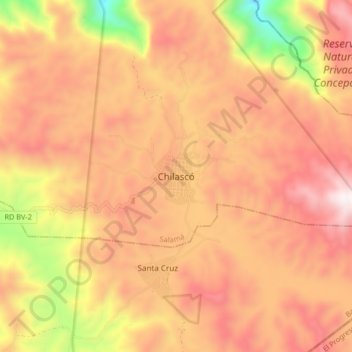
Name: Chilascó topographic map, elevation, terrain.
Location: Chilascó, Salamá, Baja Verapaz, Guatemala (15.08220 -90.15612 15.16220 -90.07612)
Average elevation: 5,988 ft
Minimum elevation: 3,822 ft
Maximum elevation: 7,346 ft
Thank you for supporting this site ❤️
Make a donation
Make a donation
Gear up for your next adventure:
As an Amazon Associate, this site earns from qualifying purchases at no extra cost to you.