Geolocate

Wenshui topographic map

Click on the map to display elevation.

About this map

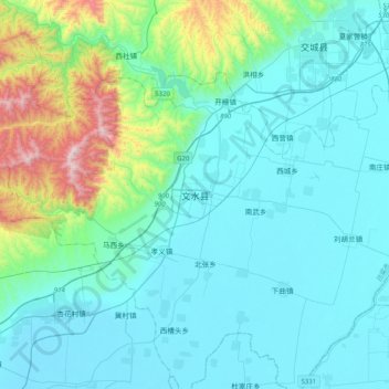
Name: Wenshui topographic map, elevation, terrain.

Location: Wenshui, Fengcheng, Wenshui County, Lüliang, Shanxi, China (37.27221 111.87054 37.59221 112.19054)

Average elevation: 2,972 ft

Minimum elevation: 2,405 ft

Maximum elevation: 6,135 ft

Gear up for your next adventure:

👖Convertible Hiking Pants - Versatile zip-off pants for changing altitudes and temperatures
🍳Camping Cook Set - Complete cookware for outdoor meals
🧣Hiking Neck Gaiter - Multi‑use neck protection for outdoor weather
👟Trail Running Shoes - Lightweight shoes for trail runners
🛡️Insect Repellent - Protection against bugs during outdoor activities

As an Amazon Associate, this site earns from qualifying purchases at no extra cost to you.