
Torres topographic map
Click on the map to display elevation.
About this map
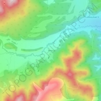
Name: Torres topographic map, elevation, terrain.
Location: Torres, Las Animas County, Colorado, United States (37.04947 -105.07611 37.08947 -105.03611)
Average elevation: 8,593 ft
Minimum elevation: 8,031 ft
Maximum elevation: 9,459 ft
Las Animas County trails, hiking, mountain biking, running and outdoor activities
Other topographic maps
Click on a map to view its topography, its elevation and its terrain.
Trinidad Lake State Park
United States > Colorado > Las Animas County > Trinidad
Average elevation: 6,450 ft
Kim
United States > Colorado > Las Animas County
Kim is located on the plains of southeastern Colorado and the elevation is 5690 ft (1734 m).
Average elevation: 5,692 ft
Kim
United States > Colorado > Las Animas County
Kim is located on the plains of southeastern Colorado and the elevation is 5690 ft (1734 m).
Average elevation: 5,689 ft