
Thank you for supporting this site ❤️
Make a donation
Make a donation
Gear up for your next adventure:
As an Amazon Associate, this site earns from qualifying purchases at no extra cost to you.
Cortiana topographic map
Click on the map to display elevation.
Thank you for supporting this site ❤️
Make a donation
Make a donation
Gear up for your next adventure:
As an Amazon Associate, this site earns from qualifying purchases at no extra cost to you.
About this map
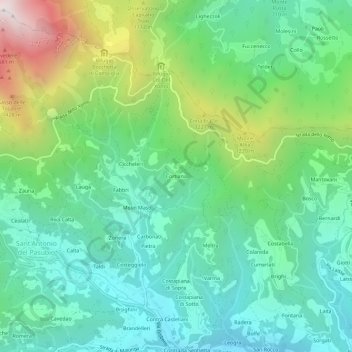
Name: Cortiana topographic map, elevation, terrain.
Location: Cortiana, Valli del Pasubio, Vicenza, Veneto, Italia (45.74456 11.21967 45.78456 11.25967)
Average elevation: 2,638 ft
Minimum elevation: 1,220 ft
Maximum elevation: 6,194 ft
Thank you for supporting this site ❤️
Make a donation
Make a donation
Gear up for your next adventure:
As an Amazon Associate, this site earns from qualifying purchases at no extra cost to you.