
Thank you for supporting this site ❤️
Make a donation
Make a donation
Gear up for your next adventure:
As an Amazon Associate, this site earns from qualifying purchases at no extra cost to you.
Baldriz topographic map
Click on the map to display elevation.
Thank you for supporting this site ❤️
Make a donation
Make a donation
Gear up for your next adventure:
As an Amazon Associate, this site earns from qualifying purchases at no extra cost to you.
About this map
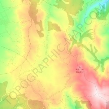
Name: Baldriz topographic map, elevation, terrain.
Location: Baldriz, Cualedro, Verín, Orense, Galicia, España (42.01262 -7.55919 42.07379 -7.50554)
Average elevation: 2,638 ft
Minimum elevation: 1,696 ft
Maximum elevation: 3,556 ft
Thank you for supporting this site ❤️
Make a donation
Make a donation
Gear up for your next adventure:
As an Amazon Associate, this site earns from qualifying purchases at no extra cost to you.