
Thank you for supporting this site ❤️
Make a donation
Make a donation
Gear up for your next adventure:
As an Amazon Associate, this site earns from qualifying purchases at no extra cost to you.
Melengadi topographic map
Click on the map to display elevation.
Thank you for supporting this site ❤️
Make a donation
Make a donation
Gear up for your next adventure:
As an Amazon Associate, this site earns from qualifying purchases at no extra cost to you.
About this map
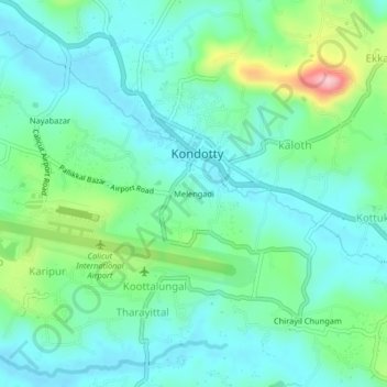
Name: Melengadi topographic map, elevation, terrain.
Location: Melengadi, Kondotty, Malappuram, Kerala, 673638, India (11.12155 75.94403 11.16155 75.98403)
Average elevation: 207 ft
Minimum elevation: 52 ft
Maximum elevation: 696 ft
Thank you for supporting this site ❤️
Make a donation
Make a donation
Gear up for your next adventure:
As an Amazon Associate, this site earns from qualifying purchases at no extra cost to you.