
Vianden topographic map
Interactive map
Click on the map to display elevation.
About this map
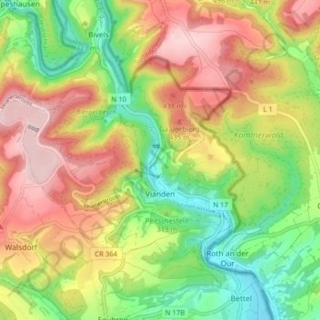
Name: Vianden topographic map, elevation, terrain.
Location: Vianden, Canton Vianden, Luxembourg (49.92283 6.14895 49.95520 6.22733)
Average elevation: 1,119 ft
Minimum elevation: 630 ft
Maximum elevation: 1,660 ft
Other topographic maps
Click on a map to view its topography, its elevation and its terrain.
Bivels
Bivels, Putscheid, Canton Vianden, 9453, Luxembourg
Average elevation: 1,220 ft