Geolocate

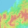
Izu topographic map

Click on the map to display elevation.

About this map

Name: Izu topographic map, elevation, terrain.

Location: Izu, Shizuoka Prefecture, Chubu Region, Japan (34.82638 138.58345 35.01619 139.06883)

Average elevation: 686 ft

Minimum elevation: 0 ft

Maximum elevation: 4,501 ft

Other topographic maps

Click on a map to view its topography, its elevation and its terrain.

300M

Japan > Nagasaki

Average elevation: 722 ft

Osaka Prefecture

Japan

Average elevation: 617 ft

Takeda Castle

Japan > Asago

Average elevation: 571 ft

Akaishi Mountains

Japan > Oshika

Average elevation: 8,501 ft

Iwo to

Japan > Tokyo > Ogasawara

Average elevation: 0 ft

葭町

Japan > Matsumoto

Average elevation: 2,021 ft

Nishikigaoka-chuo Park

Japan > Sendai

Average elevation: 646 ft

Nakauonuma County

Japan

Average elevation: 1,985 ft

Mount Yatsugatake viewpoint

Japan > Suwa County > Fujimi

Average elevation: 5,715 ft

Gear up for your next adventure:

🪶Wildlife Field Guides - Learn animal tracking and species ID
🌡️Handheld Weather Meters - Measure wind, temp, and pressure for safe mountain travel
🧦Merino Wool Socks - Moisture-wicking, blister-preventing socks for long treks
📡Handheld GPS Device - Reliable handheld GPS for outdoor navigation
🕶️Glacier Sunglasses - Side shields to protect eyes from high-altitude snow glare

As an Amazon Associate, this site earns from qualifying purchases at no extra cost to you.