Geolocate

Moretti topographic map

Click on the map to display elevation.

About this map

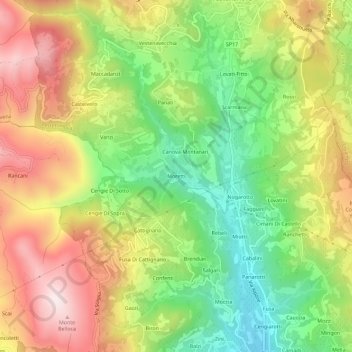
Name: Moretti topographic map, elevation, terrain.

Location: Moretti, Vestenanova, Verona, Veneto, 37030, Italia (45.53324 11.19870 45.57324 11.23870)

Average elevation: 1,631 ft

Minimum elevation: 705 ft

Maximum elevation: 2,677 ft

Gear up for your next adventure:

🚗GPS Dash Cams - Record your scenic drives through mountain passes and canyons
🪶Paracord Bracelet - Survival bracelet with built‑in tools
🪶Thermal Camp Blanket - Extra warmth for cold nights
📌Outdoor GPS Map App - Apps and devices for digital topographic navigation
🧭Map Reading Tools - Tools and kits for map navigation

As an Amazon Associate, this site earns from qualifying purchases at no extra cost to you.