
Zeeland topographic map
Click on the map to display elevation.
Zeeland
According to the United States Census Bureau, the city has a total area of 3.01 square miles (7.80 km2), of which 2.99 square miles (7.74 km2) is land and 0.02 square miles (0.05 km2) is water. The town itself is located on a hill, giving the city a higher elevation compared to the surrounding township land. Much of the outlying areas contain farmland and forest.
About this map
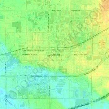
Name: Zeeland topographic map, elevation, terrain.
Location: Zeeland, Ottawa County, Michigan, 49464, United States (42.79792 -86.03849 42.82690 -85.98965)
Average elevation: 640 ft
Minimum elevation: 591 ft
Maximum elevation: 689 ft
Ottawa County trails, hiking, mountain biking, running and outdoor activities
Other topographic maps
Click on a map to view its topography, its elevation and its terrain.
Pine Creek
United States > Michigan > Ottawa County > Holland Charter Township
Average elevation: 620 ft