Geolocate

Winslow topographic map

Click on the map to display elevation.

About this map

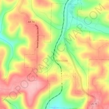
Name: Winslow topographic map, elevation, terrain.

Location: Winslow, Washington County, Arkansas, United States (35.78658 -94.14535 35.81691 -94.11406)

Average elevation: 1,844 ft

Minimum elevation: 1,558 ft

Maximum elevation: 2,060 ft

Washington County trails, hiking, mountain biking, running and outdoor activities

Gear up for your next adventure:

🚪Portable Camp Chair - Foldable chair for comfort at camp
🔋Rechargeable Batteries - Power up your outdoor devices
🥄Camping Utensil Set - Lightweight utensils for outdoor meals
🧭GPS Watch Accessories - Bands and chargers for GPS watches
🔦LED Headlamp - Bright and durable LED headlamp for night navigation

As an Amazon Associate, this site earns from qualifying purchases at no extra cost to you.