Geolocate

Edenton topographic map

Click on the map to display elevation.

About this map

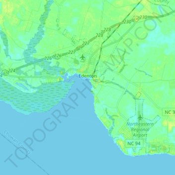
Name: Edenton topographic map, elevation, terrain.

Location: Edenton, Chowan County, North Carolina, 27932, United States (36.00957 -76.68309 36.09205 -76.55375)

Average elevation: 10 ft

Minimum elevation: -7 ft

Maximum elevation: 39 ft

Chowan County trails, hiking, mountain biking, running and outdoor activities

Other topographic maps

Click on a map to view its topography, its elevation and its terrain.

Gear up for your next adventure:

📚USA Hiking Guide Books - Top trail guides and map books
🔭Compact Binoculars - HD vision for scouting terrain and identifying distant landmarks
Solar GPS Watches - Advanced multisport watches with built-in topographic maps
👟Trail Running Shoes - Lightweight shoes for trail runners
Camping Coffee Makers - Enjoy premium coffee at the summit or campsite

As an Amazon Associate, this site earns from qualifying purchases at no extra cost to you.