Geolocate

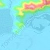
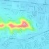
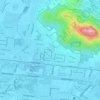
Victoria Park topographic map

Click on the map to display elevation.

About this map

Name: Victoria Park topographic map, elevation, terrain.

Location: Victoria Park, South Townsville, Townsville, Townsville City, Queensland, Australia (-19.26937 146.82397 -19.26591 146.82713)

Average elevation: 23 ft

Minimum elevation: 0 ft

Maximum elevation: 203 ft

Other topographic maps

Click on a map to view its topography, its elevation and its terrain.
Magnetic Island

Australia > Queensland > Townsville

Average elevation: 105 ft

Bald Rock

Australia > Queensland > Townsville

Average elevation: 92 ft

Hervey Range

Australia > Queensland > Townsville

Average elevation: 545 ft

Mount Louisa

Australia > Queensland > Townsville

Average elevation: 92 ft

Castle Hill

Australia > Queensland > Townsville

In 1983 a further 33 hectares (82 acres) were granted to Yarrawonga Pty Ltd under special lease as a potential development site. The Yarrawonga subdivision is situated in the foothills of Castle Hill. With views of North Ward and Magnetic Island; it has been described as the most expensive real estate outside…

Average elevation: 131 ft
Mount Stuart

Australia > Queensland > Townsville

Average elevation: 984 ft

Castle Hill

Australia > Queensland > Townsville

Average elevation: 128 ft

Pallarenda

Australia > Queensland > Townsville

Average elevation: 46 ft

Castle Hill

Australia > Queensland > Townsville

Average elevation: 128 ft

West End

Australia > Queensland > Townsville

Average elevation: 105 ft

Gear up for your next adventure:

🪶Wildlife Field Guides - Learn animal tracking and species ID
🔋Rechargeable Batteries - Power up your outdoor devices
🔦LED Headlamp - Bright and durable LED headlamp for night navigation
🪶Fire Starter Kit - Reliable fire starter for survival and camping
🪶Thermal Camp Blanket - Extra warmth for cold nights

As an Amazon Associate, this site earns from qualifying purchases at no extra cost to you.