
Pardee topographic map
Click on the map to display elevation.
About this map
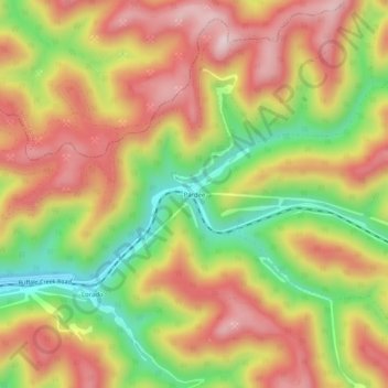
Name: Pardee topographic map, elevation, terrain.
Location: Pardee, Logan County, West Virginia, 25630, United States (37.78594 -81.72150 37.82594 -81.68150)
Average elevation: 1,906 ft
Minimum elevation: 1,171 ft
Maximum elevation: 2,523 ft
Logan County trails, hiking, mountain biking, running and outdoor activities
Other topographic maps
Click on a map to view its topography, its elevation and its terrain.
Greenville
United States > West Virginia > Logan County > Greenville > Hensley Heights
Average elevation: 1,217 ft
Monaville
United States > West Virginia > Logan County > Rossmore > Dog Patch
Average elevation: 1,132 ft