
Miami Township topographic map
Interactive map
Click on the map to display elevation.
About this map
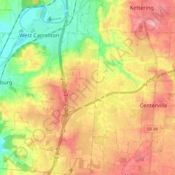
Name: Miami Township topographic map, elevation, terrain.
Location: Miami Township, Montgomery County, Ohio, United States (39.58492 -84.32830 39.69413 -84.20091)
Average elevation: 892 ft
Minimum elevation: 682 ft
Maximum elevation: 1,096 ft
Montgomery County trails, hiking, mountain biking, running and outdoor activities
Other topographic maps
Click on a map to view its topography, its elevation and its terrain.