Geolocate

Buhang topographic map

Click on the map to display elevation.

About this map

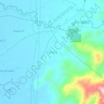
Name: Buhang topographic map, elevation, terrain.

Location: Buhang, Hamtic, Antique, Western Visayas, 5715, Philippines (10.71239 121.97724 10.75239 122.01724)

Average elevation: 141 ft

Minimum elevation: 0 ft

Maximum elevation: 1,017 ft

Gear up for your next adventure:

🥾Women's Hiking Boots - Top-rated trail boots with ankle support and superior grip
🦶Carbon Trekking Poles - Reduce knee impact on steep descents with ultra-light poles
🥇GPS Hiking Watch - Multi‑sport GPS watch with navigation and trail tracking
🕶️Glacier Sunglasses - Side shields to protect eyes from high-altitude snow glare
🥘Titanium Cookware - Durable, featherlight pots and pans for backpacking

As an Amazon Associate, this site earns from qualifying purchases at no extra cost to you.