
Thank you for supporting this site ❤️
Make a donation
Make a donation
Gear up for your next adventure:
As an Amazon Associate, this site earns from qualifying purchases at no extra cost to you.
Caribayona topographic map
Click on the map to display elevation.
Thank you for supporting this site ❤️
Make a donation
Make a donation
Gear up for your next adventure:
As an Amazon Associate, this site earns from qualifying purchases at no extra cost to you.
About this map
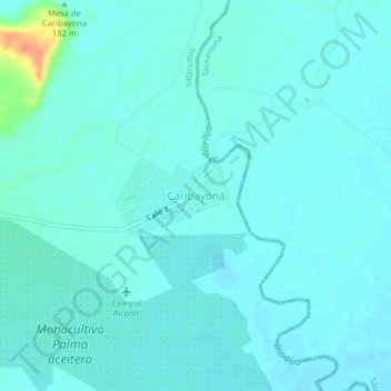
Name: Caribayona topographic map, elevation, terrain.
Location: Caribayona, Villanueva, Casanare, RAP Llanos, Colombia (4.47703 -72.77314 4.51703 -72.73314)
Average elevation: 591 ft
Minimum elevation: 571 ft
Maximum elevation: 705 ft
Thank you for supporting this site ❤️
Make a donation
Make a donation
Gear up for your next adventure:
As an Amazon Associate, this site earns from qualifying purchases at no extra cost to you.