
Räpina vald topographic map
Interactive map
Click on the map to display elevation.
About this map
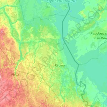
Name: Räpina vald topographic map, elevation, terrain.
Location: Räpina vald, Kreis Pölwe, Estland (57.89751 27.11085 58.40799 27.55495)
Average elevation: 148 ft
Minimum elevation: 82 ft
Maximum elevation: 377 ft
Other topographic maps
Click on a map to view its topography, its elevation and its terrain.
Tooste küla
Tooste küla, Räpina vald, Kreis Pölwe, 64424, Estland
Average elevation: 115 ft